Program Information
-
Location: Downtown Milwaukee Campus
- Pathway: STEM
- Program Code: 30-607-1
- Offering: In-Person
- Degree Type: Technical Diploma
- Start Dates: August/January
About the Surveying and Mapping Diploma
DESCRIPTION
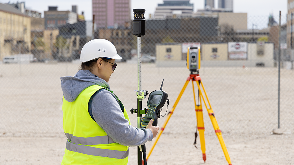
As a surveying technician, graduates of this program typically work under the direction of an engineer or surveyor to operate surveying equipment, record measurements, and produce drawings showing boundaries, key locations, elevations and other terrain features.
Surveying and mapping technicians are needed in all phases of construction, and employer demand is good in the current job market.
You can apply your credits toward completing the Civil Engineering Technology associate degree.
Additional program details: This program prepares students to perform surveying and mapping duties used in construction, boundary location, road building, mapmaking and other purposes.
Students learn to measure, analyze, manage, and present spatial data using state-of-the-art surveying equipment and CAD software. As a surveying technician, program graduates can expect to work under the direction of an engineer or surveyor to operate surveying equipment, record measurements, and produce drawings showing boundaries, key locations, elevations and other terrain features.
READY TO TAKE THE NEXT STEP?
Use the buttons below to get more information, visit the college or apply now.
Request Info Visit Us Apply Now
Career Outlook
Related Programs
Detailed Program Information
2025-26 Curriculum
| Course | Course Name | Credits |
|---|---|---|
| CIVIL-101 | Civil Engineering Drawing | 2 |
| CIVIL-102 | Introduction to AutoCAD | 2 |
| CIVIL-105 | Computer Applications | 2 |
| CIVIL-155 | Surveying 1 | 2 |
| MATH-115 | College Technical Mathematics 1 ‡ (or) MATH-201 College Algebra ‡ |
5 |
| CIVIL-106 | Intermediate AutoCAD ‡ | 2 |
| CIVIL-156 | Surveying 2 ‡ | 2 |
| ENG-195 | Written Communication ‡ (or) ENG-201 English 1 ‡ |
3 |
| CIVIL-110 | Introduction to Civil 3D ‡ | 2 |
| CIVIL-157 | Route and Highway Surveying ‡ | 3 |
| TOTAL CREDITS | 25 |
‡ Prerequisite required.
Program curriculum requirements are subject to change.
Current MATC students should consult their Academic Program Plan for specific curriculum requirements.
To see course descriptions, class times and locations, visit the full course catalog (link).
Already a student? You can visit Self-Service (link) and choose Student Planning to register for classes.
2025-2026 Program Flyer
Important Dates
Deadlines and important dates can be found on:
Cost & Aid Deadlines
Also, you can find dates and deadlines on the MATC Calendar
Program Outcomes
- Operate surveying instruments to collect data on location
- Operate Trimble data collection systems, GPS receivers and robotic total stations
- Draft and analyze traverse field data using Autodesk Civil 3-D software
- Illustrate basic drawings of circular horizontal curves, vertical curves, plans, profiles and cross-sections
Admission Requirements
High school diploma or equivalent
Academic Preparedness Requirements
Scholarships
Accreditation
This program is approved through the Professional Land Surveyor Section of the Wisconsin Examining Board of Architects, Landscape Architects, Professional Engineers, Designers and Professional Land Surveyors; Department of Safety and Professional Services, P.O. Box 8366, Madison, WI 53708-8366; 608-266-2112;
https://dsps.wi.gov/Pages/BoardsCouncils/AE/LandSurveyor/Default.aspx.
READY TO TAKE THE NEXT STEP?
Use the buttons below to get more information, visit the college or apply now.
Request Info Visit Us Apply Now
QUESTIONS?
STEM Academic & Career Pathway
414-297-6319
stempathway@matc.edu

